
IUCN maintains many of the world’s standards for assessing species abundance as a part of work with the IUCN Red List of Threatened Species. One such guideline is the Mapping Standards and Data Quality for the IUCN Red List Spatial Data, which works to provide standardization of species monitoring to provide accurate determinations of species’ conservation status and threats.
Challenges for mapping standards
Unfortunately, the guidelines have faced challenges including:
- variances of interpretation by those assessing
- too broad of scope of species and ecosystems (terrestrial, aquatic, and fungal species are all assessed using the same metrics)
- failure to address diverse inputs (stakeholders often retain extensive data that can range from specified scientific study of a particular species to broad estimates).
Wild cats are particularly difficult to position within these guidelines as their population density, behavior, and habitat varies greatly by location. Leopards, for example, occupy territories from Asia to Africa with great variation in subspecies status. In Africa, leopard populations in the East and South are thriving but in the North and West species are rare, fragmented or absent. Data is also highly inconsistent with some well-monitored areas containing detailed scientific studies to remote or conflict-prone regions that lack any tracking.
An additional difficulty to standardization of wild cat populations is that they often reside in remote habitats, elusive to human tracking. Camera tracking has somewhat improved the ability to gather data but is limited by cost and logistical constraints.
The new guidelines for wild cat distribution: a way forward
As such, development of new guidelines for mapping has used wild cats as a test case. These improved metrics were developed from the expertise of the IUCN SSC Cat Specialist Working Group, a collaboration of over 200 of the world’s wild cat experts, including scientists, conservation managers, wildlife rangers, and other stakeholders. The new standards will be tested using the IUCN Red List and Green Status of Species Assessments and the African Carnivore Initiative.
The study recently turned in its final report from which the key takeaways have been:
- There are a variety of sources from which data can be collected, including distribution maps and the public.
- Mapping efforts and other forms of data need a classification of their quality.
- The use of Species Distribution Models can inform areas where further information beyond observational data is needed.
- Analysis of data from observations will likely differ by taxon based on life history, roaming range, habitat, prey distribution, conservation rates in the area, etc.
This research was made possible through an estate gift administered through IUCN-US.
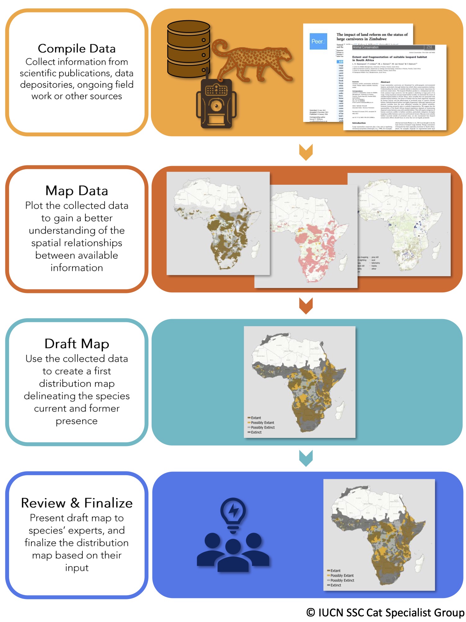
Updated steps to mapping process under the new guidelines produced in collaboration with the IUCN SSC Cat Specialist Group.